How a Ridge Changes the View from a Valley
How a ridge changes the view from a valley: sketch the terrain to see why nearby summits vanish, which sightlines open, and where to look next.
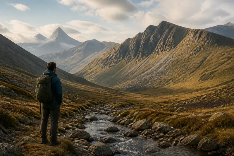
The common mistake in reading a mountain view is to assume that the nearest summit should be visible. A ridge can hide it completely, while a more distant peak appears over the ridge’s shoulder. That simple obstruction can send a walker looking for the wrong landmark or make a familiar valley seem oddly unfamiliar. A quick cross-section helps explain what is happening.
To understand how a ridge changes the view from a valley, treat the landscape as a side-on drawing: observer, rising slope, crest, then the land beyond. This is not a map and does not show every bend in the ground. It answers a narrower question: does the ground between the observer and a distant point cut across the line of sight?
One Valley, Several Views
A valley is not a viewing platform with a single, fixed panorama. Its floor, side slopes, tributary gullies, and bends put an observer at different heights and angles. A ridge then divides the scene into what lies in front of it and what can be seen beyond its crest.
From a low spot on the valley floor, the near side of the ridge may fill much of the view. A peak beyond it can be hidden even if it is close on a map. Move along the valley toward a bend, and the ridge may end or swing aside. The same peak can appear without the observer gaining much height.
Move uphill instead, and a different change may happen. The line from the observer’s eyes to the distant peak now passes higher over the near slope. The peak can emerge above the crest. But that does not mean every feature beyond the ridge will show: a shoulder, spur, or second ridge may still block part of the view.
It helps to separate three questions. Is the target behind the ridge? Does the sightline clear the crest? And, if it clears, does the target stand high enough above the skyline to be recognized? A “yes” to the second question does not always mean an obvious view.
Draw the Cross-Section
Start with a sheet of paper and draw a horizontal ground line. Mark a point on the left for the observer, then sketch the valley floor rising into the near slope and crest of a ridge. Continue the line down into a hollow or up to a distant summit. The profile can be rough; its purpose is to show the order and relative shape of the land.
Now mark the observer’s eye above the ground point. Draw a straight line from that eye to the distant summit. If the line cuts through the ridge, the summit is hidden from that position. If the line passes above the crest, the summit is geometrically visible from that position, at least in this simplified profile.
Try drawing a second line from the same eye to a point lower on the far slope. The ridge may hide that point while leaving the summit visible. The view is not simply “open” or “closed”; one part of the far landscape may show while another remains behind the crest.
On a sketch, label the observer, near slope, ridge crest, far slope, and target. Use a few gentle curves rather than jagged peaks unless the terrain really has sharp breaks. If the ridge has a broad top, draw its width. A broad crest can block more of the view than a narrow summit point suggests.
- Observer: Where are your eyes in relation to the valley floor and side slope?
- Near slope: Does it climb steadily, or does a spur project toward the valley?
- Ridge crest: Is it a narrow high point, a broad back, or a series of shoulders?
- Target: Are you trying to see a summit, a pass, a cliff band, or a lower valley?
- Sightline: Does the straight line from observer to target clear the highest intervening ground?
The sketch is a thinking aid, not a precision survey. A paper profile can show why a target might be hidden, but it will not settle every detail of an actual view. A small hollow or spur omitted from the drawing can make a noticeable difference outdoors.
Why a Nearby Summit Vanishes
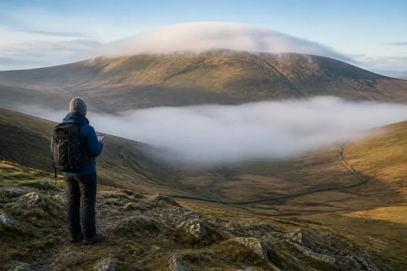
Imagine you are standing beside a stream at the bottom of a valley. A summit you want to identify lies beyond a ridge. On your sketch, the line from your eye to the summit runs straight through the ridge’s near slope. The summit is close in walking terms, but the intervening ground occupies the same direction in your view. It disappears behind the ridge.
Now imagine walking a short way up a side slope. You redraw the observer higher on the cross-section. The line to the summit may now skim above the ridge crest. A small part of the summit appears first, perhaps just a shoulder or a patch of skyline. From a little farther up, more of its outline may show.
That change can be surprisingly modest. You do not need to reach the summit or cross the ridge to alter the view. A rise in the valley floor, a hillside path, or a bend around a spur may shift the observer enough to uncover a landmark.
There is a useful distinction between a ridge crest and a summit. The highest point of a ridge may be out of sight, while a lower saddle or shoulder is visible. Conversely, a far summit can show above the crest even though its lower slopes remain hidden. In a real landscape, the visible outline is often a sequence of partial shapes rather than a clean mountain silhouette.
Distance can mislead, too. Nearby features may look small if they are partly screened, while a distant summit can look prominent because its upper outline rises clear against the sky. A view tells you where the line of sight travels; it does not, by itself, tell you how far away each feature is.
Changing the Valley Position
When a target vanishes, do not immediately climb higher. First consider moving sideways along the valley. A ridge often has a shoulder, notch, or end where the obstruction narrows. From a different point on the valley floor, the line of sight may pass beside the ridge rather than through it.
This is a matter of alignment. If a near spur lies between you and the target, shifting to one side can move the spur out of the way. The target may then be seen through a gap, even though the ridge itself has not changed and your elevation is nearly the same.
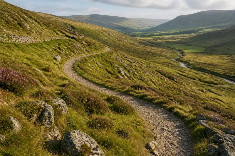
Imagine a walker trying to identify a distant summit from a stream bend. The cross-section suggests that a side spur blocks the direct line. The walker follows the valley path to the next open bend, then compares the skyline again. The summit’s upper edge is expected to appear beside the spur, while its lower slope stays hidden. If that is what the view offers, the change in position has revealed the obstruction’s shape as well as the target.
At another point, the opposite may happen. A near slope that looked like one broad wall from the valley floor can split into separate ridges when seen from a side path. The apparent wall was a foreground overlap: several landforms lined up from the first viewpoint. The altered angle separates them.
For a useful comparison, pause at a few safe, open points rather than trying to record every turn. Note which summit is visible, where it meets the skyline, and what landform seems to cover its lower part. A simple note such as “peak above left shoulder; base hidden” is more helpful than a vague impression that the view has opened up.
Read the Shape of the Block
What hides a target can help you understand the terrain in front of it. A smooth, continuous barrier suggests a broad slope or ridge back. A notch in the skyline may mark a saddle, while a rounded projection can indicate a shoulder. These clues are strongest when you compare the same features from more than one position.
Do not assign a landform name from one silhouette alone. A “notch” in the view may be a gap between two separate ridges, or it may be a shallow saddle along one ridge. Walk to another viewpoint, or check a contour map if you have one. If the opening shifts relative to the nearby slopes, you may be seeing different pieces of terrain overlap.
A map and a sketch answer different questions. Contour lines show the pattern of rising and falling ground from above. A cross-section makes that ground easier to imagine from the side. If a map shows a spur between your location and a target, the sketch can clarify why the spur masks the target from one angle but not another.
For a hand-drawn profile, choose a line that roughly follows your view: from your position toward the target, crossing the ridge that seems to block it. A route line on a map may not follow that direction, so do not assume the path’s profile will explain the view. The viewing line and walking line are different routes across the landscape.
Questions About Ridge Views?
Can I see a summit but not its lower slopes?
Yes. The sightline to the summit may clear the ridge while a line to lower ground passes through it. The result is a peak above the skyline with much of its base hidden.
Why does a peak appear as I walk along a valley?
Your position changes the angle between your eyes, the intervening ridge, and the target. A bend or a move past a spur can open a gap without any meaningful change in height.
Does a clear skyline mean the target is close?
No. A distant feature can stand clearly above a ridge, while a nearby one remains screened by a slope. Use a map or other reliable orientation cues if distance or identity matters.
Will a cross-section show exactly what I can see?
It can explain the basic obstruction, but a single profile leaves out terrain to either side. For a complicated view, compare more than one direction or viewpoint rather than forcing the whole scene into one line.
A Light Routine Outdoors
Use the idea as a small routine, not a project. At your first open viewpoint, pick one distant landmark and one feature that seems to cover it. Sketch the ground in profile, mark your eye position, and draw the straight sightline. Then predict what might change if you move uphill or sideways.
At the next safe opening, check that prediction. Did the landmark rise above the crest, shift beside a spur, or remain hidden? Update the sketch with the new observer position. If the view differs from your drawing, look for the missing shoulder, hollow, or second ridge rather than dismissing the exercise.
On a later outing, repeat the comparison from the opposite side of the valley if the route allows. You may see the same ridge as a foreground barrier from one side and as a sequence of separate shoulders from the other. Keep the notes modest: a few lines and named features are enough to make the changing geometry memorable.
What is not worth the effort is trying to make a perfect elevation drawing while you are walking. A clean, scaled profile takes information a casual sketch does not provide, and it is unnecessary for spotting a blocked sightline. Save the detailed map work for when precise route or terrain information matters.
How a ridge changes the view from a valley becomes easier to read once “hidden” means something specific: the ground interrupts a straight line from your eyes to a target. When a summit disappears, look for the blocking crest, then test whether height or a sideways shift changes the alignment. The small patch of skyline that appears next may tell you more about the shape of the valley than a full panorama does.