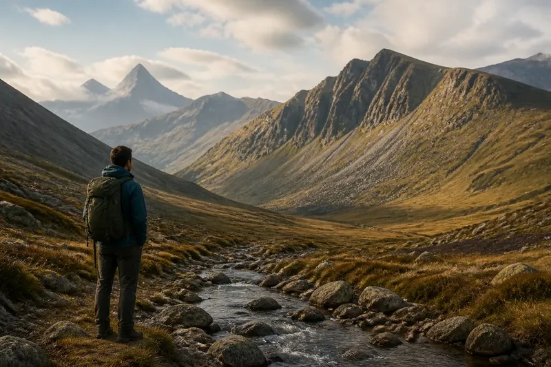
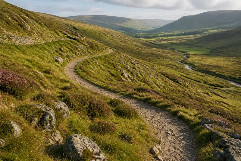
Clouds on the Summit or in the Hollow?
Learn to read clouds on a summit versus mist in a hollow by noticing their shape, movement, and setting—without treating either as a forecast.
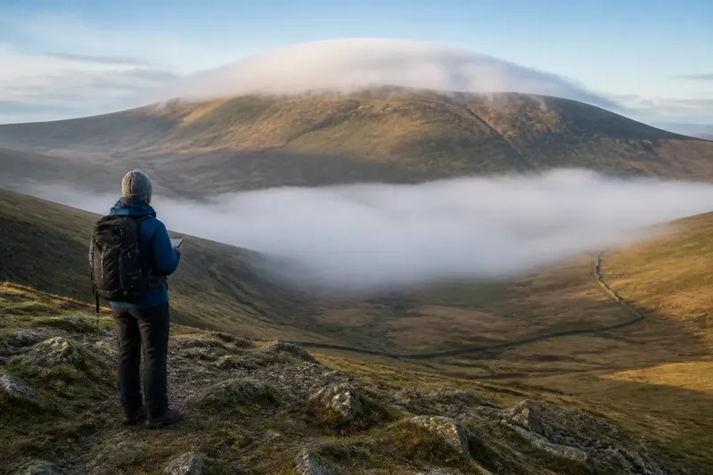
The common mistake on a hill walk is to call every low cloud “fog” and treat it as one warning; that blurs useful differences and can distract from what the terrain is actually showing. Clouds on a summit and mist in a hollow may sit close together, yet their shapes and movement tell different stories about where damp air is gathering. Neither scene, by itself, predicts what the weather will do next.
Imagine a clearly hypothetical walk on a rounded upland, with a broad, exposed summit above a shallow, sheltered hollow. The walker pauses where both are visible. Rather than guessing what the sky promises, they note the cloud’s outline, its relation to the ground, and whether it shifts. That simple comparison is the whole point: read the scene before naming it.
Two places, two scenes
On the summit, cloud may appear as a cap, a streamer, or a ragged veil that brushes the high ground. Its edges can be visible against open sky, while the land below remains clear. A cap may cling to the crest; a streamer may trail away from it; wisps may form and dissolve along the slope. Those are descriptions of what is visible, not clues that support a dependable forecast.
In the hollow, mist often looks more ground-bound. It may fill a dip like a pale pool, soften the lower slopes, or leave the surrounding ridge tops clear. Trees, walls, or a change in ground level can help show where the veil begins and ends. The hollow can seem full while nearby higher ground stays sharply outlined.
“Cloud” and “mist” are everyday labels, not separate substances with a neat boundary. Both describe tiny water droplets suspended in air; the view changes with height, terrain, and the observer’s position. At a distance, it may be hard to tell whether a low veil touches the ground or hangs just above it. The honest reading can be “low cloud over the hollow,” rather than a confident label.
Read shape and movement
Start with the outline. A summit cap is attached visually to a high point: its base seems to meet the crest, or its wisps repeatedly cross the skyline. A hollow mist is organized around a depression, with edges that follow the basin or its slopes. These are useful distinctions even when the cloud’s origin is hidden from view.
Then watch for change without assuming it has a single meaning. A wisp can thin, thicken, or slide across a ridgeline. A hollow’s visible edge can retreat, spread, or break into patches. If the walker can see the same feature from a safe, stationary viewpoint, a glance after a short interval may clarify whether it is shifting or simply changing shape. No timing rule turns that observation into a forecast.
Direction is easy to misread from one vantage point. A cloud seems to move sideways when the observer changes position, or when a passing fragment replaces another in much the same place. Compare it with a fixed landmark, such as a summit cairn seen from a distance, a wall, or a notch in the skyline. If the landmark disappears, do not move toward an edge or unfamiliar ground just to improve the view.
A hypothetical walk
Say the walker reaches a broad shoulder with a rounded summit ahead and a shallow hollow below. A white cap touches the summit, but its shape is broken: a loose wisp hangs beyond the crest while the ridge’s other slopes remain visible. Down in the hollow, a smoother grey-white layer hides parts of the lower ground. The walker records two separate observations rather than calling the whole hillside “clouded in.”
From the shoulder, the summit cap’s edge flickers against the skyline. The hollow’s upper boundary, meanwhile, lies below the ridge and curves with the basin. The walker compares both features with the same landmarks, then stays put long enough to see whether their outlines alter. The cap loosens and reforms; the hollow’s edge remains distinct from the crest. That result supports a limited description: cloud is touching the high point, while mist-like low cloud is occupying the hollow.
The walker does not infer that one feature will rise, clear, or spread. Nor do they treat the hollow as a sheltered shortcut: its hidden ground could make footing or navigation harder, even if the ridge above appears bright. They check their route against a map and their current visibility, then choose only terrain they can identify and navigate safely. If visibility or conditions make the route uncertain, turning back or seeking local, qualified guidance is more sensible than relying on cloud-reading alone.
The lesson is not that the summit cap and hollow mist have a fixed meaning. It is that the land gives each a different visible frame. The high point supplies a skyline for cloud edges; the hollow supplies a basin for low cloud to collect within. Keeping those observations distinct makes the account more accurate, while leaving prediction to a proper weather forecast.
What can you tell?
Does a summit cloud mean rain?
Not on its own. A cap or streamer shows cloud in contact with, or close to, the high ground; it does not establish what will happen later. Use a current forecast and conditions on the route for decisions.
Why can a hollow look cloudier?
Low cloud or mist can be more visible where the terrain dips and the surrounding slopes frame its edge. That appearance describes the scene, not a reliable account of how the weather will develop.
Can I distinguish mist from low cloud?
Sometimes the ground gives a helpful clue: a veil visibly touching the surface is commonly called mist, while a low layer that seems suspended may be described as cloud. From a distant ridge, the contact point can be impossible to see, so “low cloud” is a cautious description.
Should I enter a cloud-filled hollow?
Cloud shape alone cannot settle that choice. Consider whether you can identify the route, keep track of your position, and see hazards; if not, avoid continuing into terrain you cannot assess and follow suitable local safety guidance.
Make the observation useful
A brief field note can preserve what the eye actually saw. Write the feature’s place, its outline, and its relation to the ground: “broken cap on the summit; smooth veil below the ridge in the hollow.” Add whether the edge changed against a fixed landmark. Avoid labels such as “storm coming” unless a forecast or other reliable information supports that claim.
A phone camera can help compare a scene later, but it is not a substitute for a map, compass, suitable navigation device, or current forecast. Exposure can wash out a pale cloud; a wide-angle lens can make a hollow appear farther away or smaller than it feels. If taking a photograph means stopping in an exposed or awkward spot, skip it and attend to the path.
What is not worth the effort? Trying to identify the exact cloud type from a distant, shifting view. A precise-sounding label can add confidence without adding useful certainty. For this comparison, shape, location, and visible change are enough.
Keep the distinction clear
When clouds gather on a summit, look for contact with the skyline, broken edges, and wisps crossing the high point. When mist sits in a hollow, look for a lower veil bounded by the basin and separated from the ridge. These observations can coexist, as they did on the invented walk, and the contrast helps describe the landscape accurately.
Clouds on a summit or in a hollow are a view to read, not a forecast to trust. Keep the main search phrase in mind as a simple comparison: where is the cloud relative to the ground, what shape does it make, and what can you safely see? If the route disappears, that last question matters more than any name for the cloud.